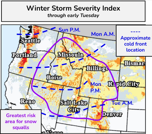
The weekend had strong spring vibes with families playing in the park and many stepping outside for fresh air and a nice walk. If this confused you into thinking spring is here then the National Weather Service NOAA Weather Prediction Center has some bad news: A strong winter storm is set to impact much of the Pacific Northwest through the Rockies over the next few days and all in that region are encouraged to prepare for heavy mountain snow, high winds, snow squalls, and dangerous travel conditions. The cold front is expected to progress southeastward today until it reaches the Rockies. Snow squalls like the ones that impacted travel conditions on Highway 40 in January are again possible with a warning of a rapid drop in visibility and a flash freeze on roads leading to dangerous conditions. The Uintah Basin is included in the large area labeled as at greatest risk for snow squalls. Even if areas of northeastern Utah miss the worst of it, much colder air is scheduled to arrive Tuesday. Anyone traveling over mountain passes are especially encouraged to stay up to date on forecasts and road conditions before heading out.


